
1847 Map Hudson River and Vicinity showing Railroads
$17.50
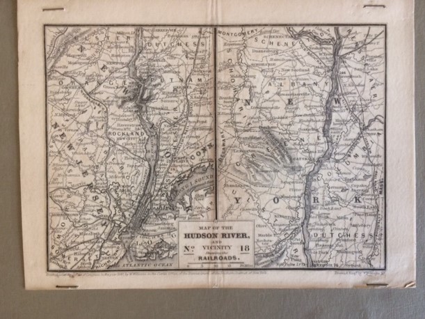
This map is from a book in 1847 that showed existing railroads. The map measures 8″ by 5 15/16″ and is in good condition. It has been stapled to a thicker piece of paper. This particular map shows the Hudson River and vicinity (New York and New Jersey). It is marked “Drawn & Engraved by W. Williams NY” and “Entered according to the Act of Congress in the year 1847”. Pre-Civil War maps are very collectible.
1 in stock
Description
This map is from a book in 1847 that showed existing railroads. The map measures 8″ by 5 15/16″ and is in good condition with a minor fold down the middle. It has been stapled to a thicker piece of paper. This particular map shows the Hudson River and vicinity (New York and New Jersey). It is marked “Drawn & Engraved by W. Williams NY” and “Entered according to the Act of Congress in the year 1847”. Pre-Civil War maps are very collectible.
Shipping for this item only is $1.50. If you are purchasing multiple items, I will calculate shipping on your total purchase based upon weight and size to save you shipping costs.


Reviews
There are no reviews yet.